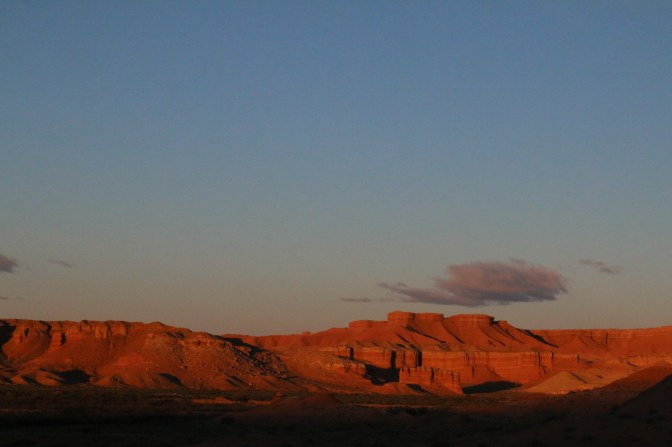
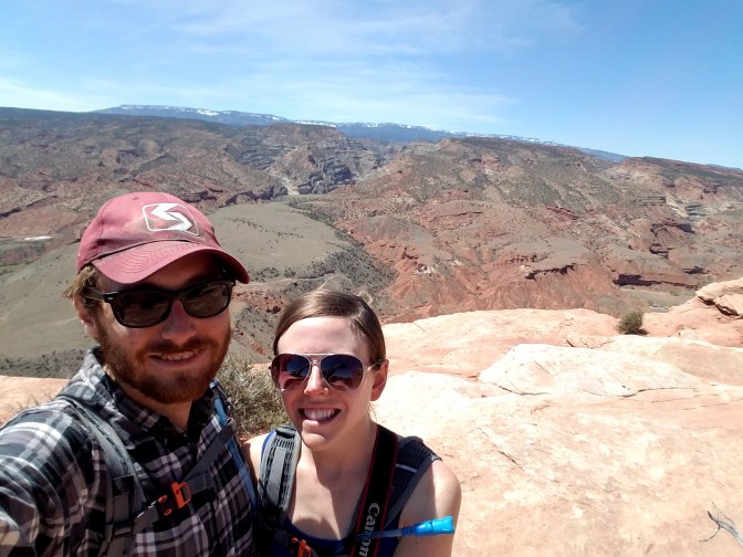
Yet another early start
As we’ve mentioned in previous posts, the increasing popularity of Utah’s natural wonders requires some pre-dawn starts to obtain a campsite. This time, we were headed from a BLM site just outside of Goblin Valley State Park to Capitol Reef National Park.


History of Capitol Reef
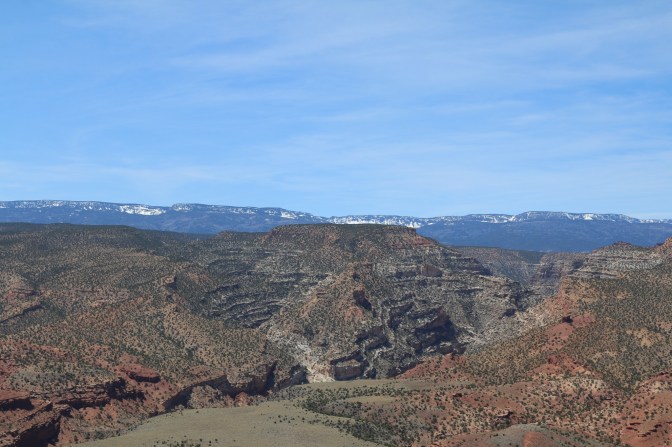
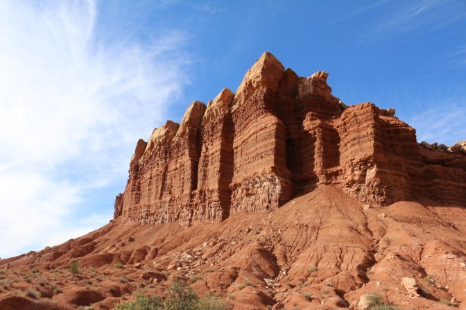
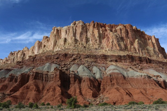
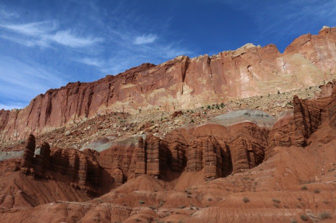
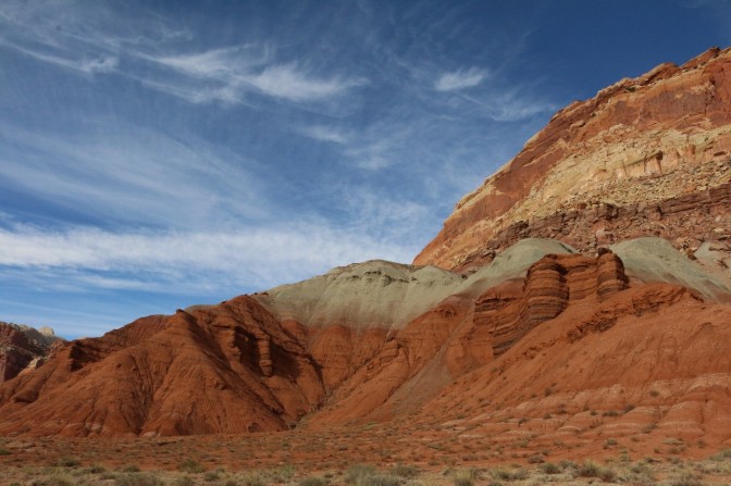
Capitol Reef National Park’s primary geologic feature is the 100-mile long Waterpocket Fold. Formed over 50 million years ago when shifting tectonic plates caused the earth’s crust to buckle and “fold” over rather than crack, the subsequent rock layers of various heights have eroded away over the years to create the current landscape. The park is not actually a fossilized reef, as some might guess, but was rather named so because the characteristic white domes resemble the Capitol Building in Washington, D.C., and because the landscape resembles an underwater reef in that it seems so formidable to pass.
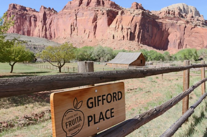
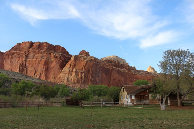
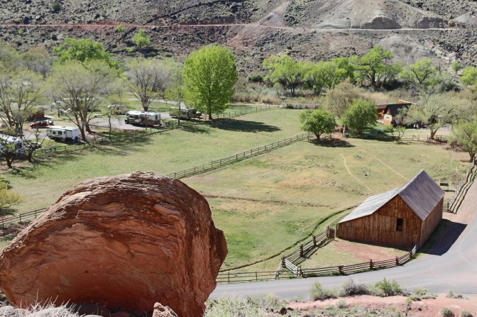
Within Capitol Reef is the historic Fruita district, a former Mormon settlement and rare and plentiful natural agricultural area within the Utah desert. The parks service still maintains an orchard that is open to visitors, who may pick and eat what they wish when harvest is in season (and pay a nominal fee, I believe, to take produce home).
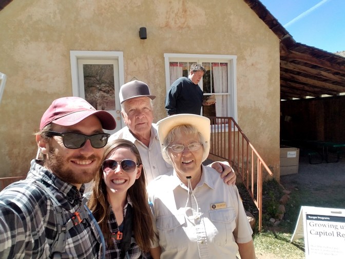
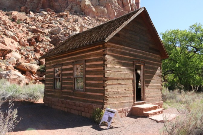
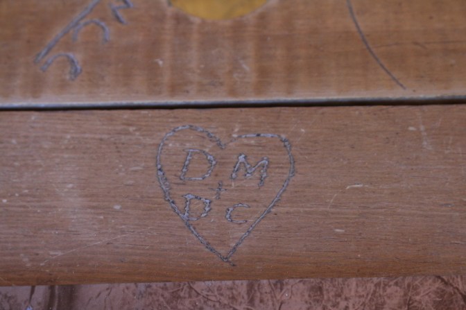
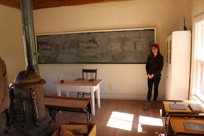
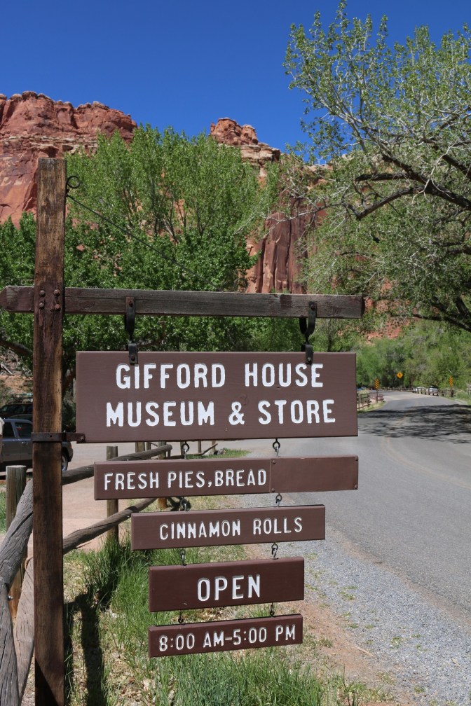
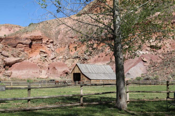
Also still on the grounds are some historic buildings from the early 20th century, including a one room schoolhouse, blacksmith shop, and the formerly residential Gifford House, which still operates as a gift shop, contains a small artifact museum, and sells enticing homemade cinnamon rolls and pies. We were fortunate to be there at a time when the Giffords themselves were volunteering their time to tell visitors a little about what life was like when they lived in Fruita. They were super sweet people, and it was amazing to hear history come to life, rather than just read the information on a sign!

Staying in Fruita
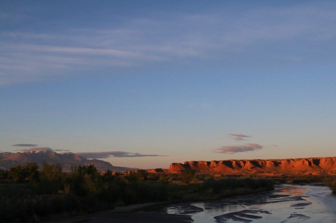
Our early start paid off yet again as we happened to pull in just as one of the best sites in Fruita campground was opening up! Right next to the Gifford House and overlooking a horse stable, it was an idyllic setting that allowed us to see why the Giffords and previous families decided to set up shop here.


Our highlights
There are about 15 trails and hikes in Capitol Reef, and while we only did a few, we felt like we got a good feel for the park overall. There were a few area slot canyons to explore that sounded awesome, but also a little bit out of our current league as far as getting around obstacles and route finding go.
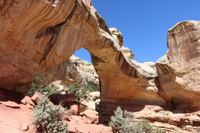
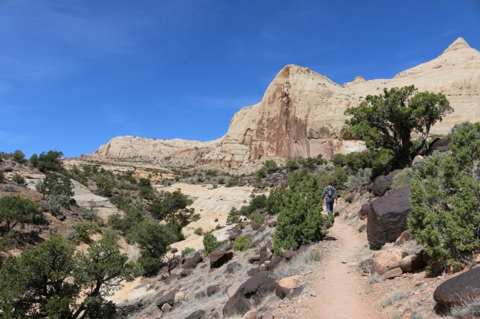
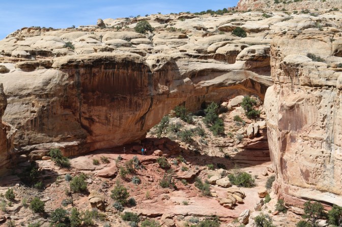
Hickman Bridge
A short, 2.0 mile round-trip hike with 400 feet of elevation gain, this was a fun trail to get to a viewpoint of a natural bridge named for an early advocate of the park’s preservation.


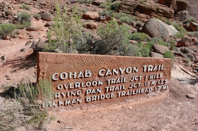
Cohab Canyon
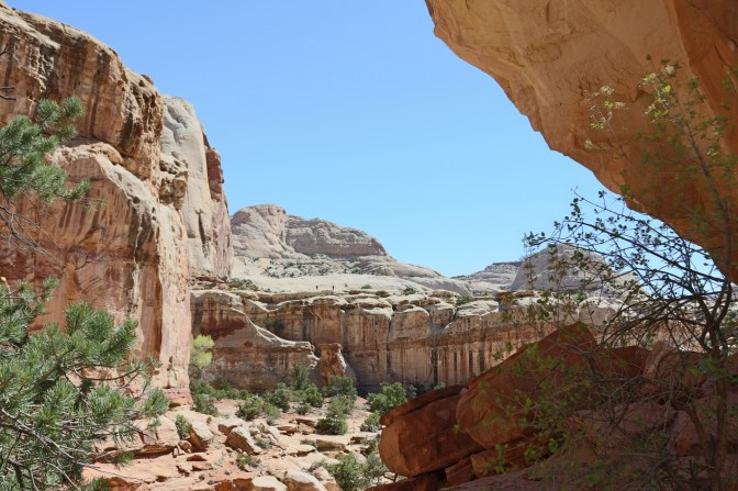
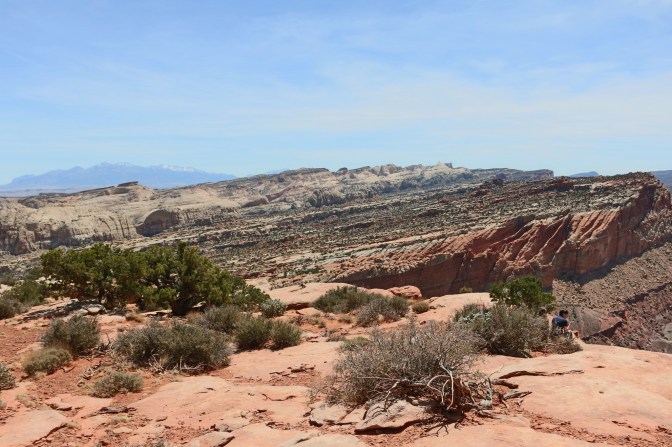
This beautiful trail led us up a few short and steep gravelly switchbacks which gave us great high up views of the Fruita region and our “house”. Once the trail leveled out, it took us through some softer gravel on the canyon floor, where there were a few breaks in the rock to explore and lots of scenery to take in. The trail ends near the parking area for Hickman Bridge, but we turned around a little before that since we had essentially already seen it. We did take the scenic overlook spur, which was well worth the little bit of extra effort.

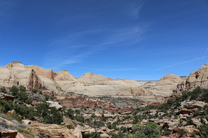


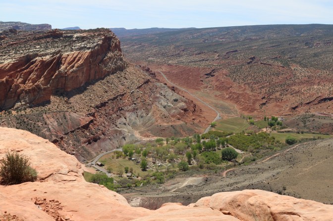
Rim Overlook
Rim Overlook branches off of the trail to Hickman Bridge and continuing past it another 2.5 miles one way is the Navajo Knobs trail. We stopped after climbing 1,100 feet to Rim Overlook – all of those 4am starts started to make us a little lazy, I think – but the views were certainly rewarding from here.


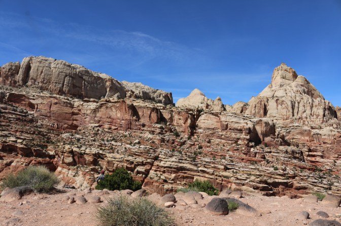
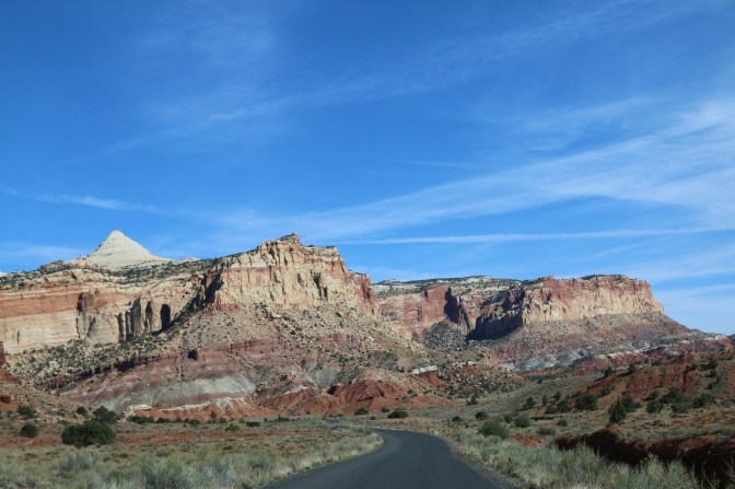
Scenic Drive and Capitol Gorge Road
We also made sure to take the so-named “scenic drive” out and back south of Fruita. We were rewarded with some spectacular scenery, which continued as we took the gravel spur road that leads to the Capitol Gorge trail. Pictures don’t quite do this part of the drive justice, but it was very cool to be zipping through the canyon while it towered a few hundred feet above us.


Things have funny timing
A side story about our stay in Capitol Reef…the afternoon before we were slated to leave, I decided to take a rare shower in the camper due to the fact that the campground had a good dump station and potable water fill, and the nearest pay showers were 11 miles away in Torrey. Immediately after, we realized that we had lost track of our propane levels and totally run out. Left without much we could eat without using the stove or opening the refrigerator and letting the cold air out (not to mention no ice was sold in the park), we were miffed at ourselves that we had to take the 22 mile each way haul out to the nearest town with propane. I always say things happen for a reason because this drive allowed us to get out to where we had cell reception and find out that John’s sister had just gotten engaged that afternoon! Not something we would have wanted to miss and that we are still so excited for! (And yes, we will DEFINITELY be home in time for the wedding! 🙂 )

Haha the Badlands is a high bar! Glad you’re enjoying it! 🙂
LikeLike
This has to be one of top parks so far. 10 times more than the Bad Lands. WOW I’m lovin it!
LikeLiked by 1 person